Adventures on the Rupert River
- Adventures on the Rupert River
- The Kattawagami River and the James Bay Coast
The Rupert River is a huge tumultuous river in northern Quebec, draining an area of 43,400 square kilometres. The Rupert originates in the largest natural lake in Quebec, Lac Mistassini, and travels for 600 km to the coast of James Bay. Tragically, the majority of the water in the Rupert has since been diverted for hydro electric development. So what you read below is of a river that once was and it is not how you will find it today.
Adventures on the Rupert River
as printed in Nastawgan: Autumn 2001 vol.28 No.3
The original article in Nastawgan can be found here.
In the previous couple of years my canoeing partner Alex and myself had been disappointed with the low water levels we had been encountering on our river trips. So for our 1999 trip we vowed to find a river with a lot of water. We certainly found it. The Rupert River begins north of Chibougamau in northern Quebec, flowing out of Mistassini Lake through hundreds of kilometers of wilderness into James Bay. It has such a strong current that it is high on Hydro Quebec’s “hope to destroy” list. We planned to drive to the south end of Mistassini Lake and paddle the 80 or 90 km up the west shore to the start of the Rupert River. We would then paddle along the Rupert River for either 600 km to Hwy 109, or 100 km further to Waskaganish on James Bay.
Setting out
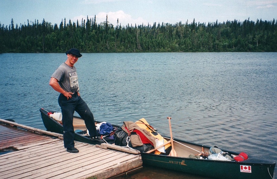
We wouldn’t be passing anywhere that we could restock, so we brought enough food for thirty days, although we didn’t think we would be that long. For trips of this length we don’t even bother to pack light since it seems like a ridiculous amount to carry either way. I know when I read about a trip, I like to hear some of the details about gear and whatnot so I’ll give a brief overview. We brought three Sealline 115L soft waterproof packs (the kind with the roll down top), and two regular hiking type packs. Once we loaded these up they weighed 55, 70, 70, 85, and 100 lbs. Our tent is the most unlikely of wilderness tents, but we like it. It is a dome tent that is big enough that we can sleep in it with all of our packs, and tall enough that you can stand in it. Alex bought it at Canadian Tire in the early 1980’s. Our canoe is a royalex Swift Yukon that is 17 ½ feet long and whitewater friendly. A fantastic boat. Our food is mostly pasta for dinner, bannock for lunch, and Just Right cereal ground in a blender and protein drinks for breakfast. We also have some extra meals of rice for those days when we’re hungry, and lots of nuts and raisins. The only thing we drink is fruit flavored carbohydrate powder that we mix with our water, increasing our caloric intake further. So with all of this assembled we were ready to go.
July 10
We arrived at Mistassini Lake at about 1PM where the guy from the Reserve faunique, who spoke very little English, did his best to ruin our plans for a canoe trip. We would have had to drive all over northern Quebec, taking up probably the first week of the trip with red tape if we wanted to satisfy him. So we decided against satisfying him. Instead of starting at the southern tip of Mistassini Lake, we would start from the east side of the lake, at the Cree community of Mistassini. This still required that we wait until Monday before starting out, but it seemed like the best alternative.
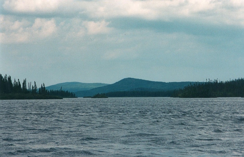
Leaving from this community had the disadvantage that we would have to cross the width of the lake. Mistassini Lake is an extremely large lake. By a rough estimation it’s area is five times Lake Simcoe’s, or twice Lake Champlain’s. So we weren’t particularly thrilled with the idea of paddling across it. For the next couple of days we hung around in a campground just outside of Chibougamau, already happy that we had brought a little chess board along.
July 12
The band council office at Mistassini Reserve opened at 8AM, so we were there at 8AM sharp. The fellow we had to see didn’t show until 8:45, but when he did show up he was extremely helpful, and not nearly as concerned about red tape as the last guy. He sold us a permit for each night we were to be in Mistassini Cree territory, and said that we could park our car at the police station if we wanted. The only thing he seemed to have in common with the Quebec representative, was his incredulity at the fact that we had never paddled the Rupert River before, and we were going to do it without a guide. This perplexed us at first, but as we got further into the trip we realized that their surprise was justified. I think that it is unusual for the river to be traveled without at least one person in the party having done it before, and for good reason. This is because even in what looks like calm water, the current is sometimes unbelievably powerful and can force you into falls or rapids before you can even see them. This almost cost us our lives several times. We also found that without knowledge of places to camp, we sometimes spent hours paddling and the best site we could find was a flat rock, a bit bigger than the tent, fifty feet into the peat hummocks.
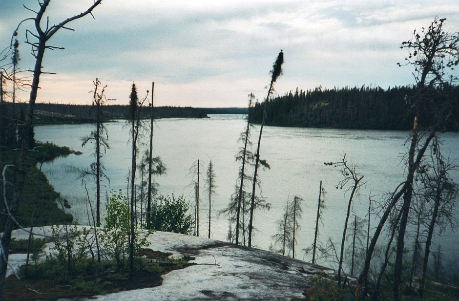
Mistassini Lake crossing from the island
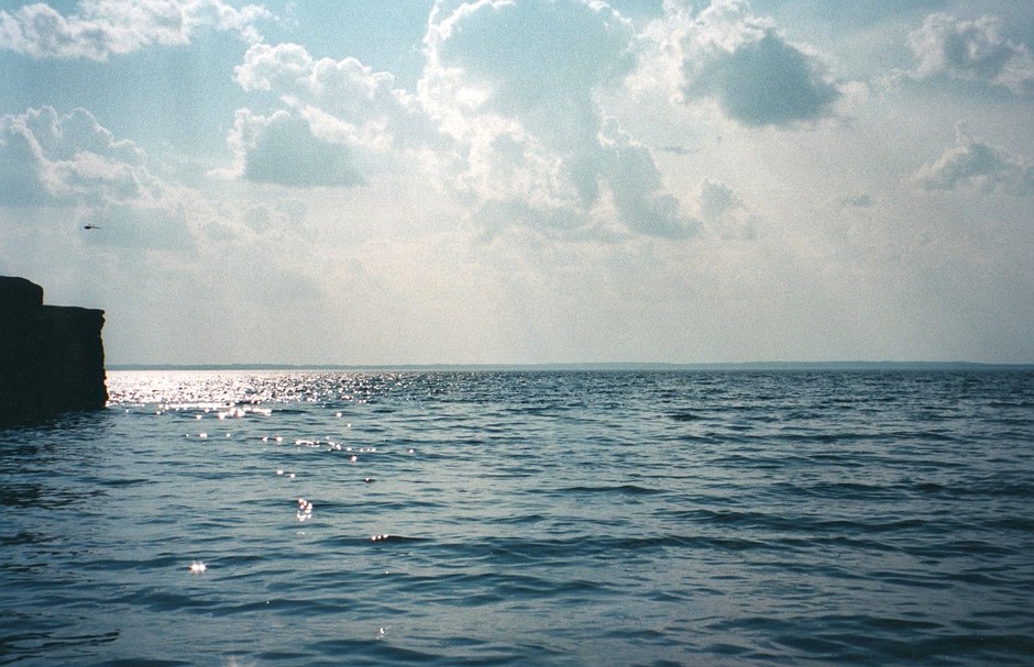
By 10:30 we were finally on the lake and ready to go. The Reserve is at the bottom of a 30km long bay. We started up the bay on a perfect day, sunny with a few clouds and a slight breeze at our back. We had reached the mouth of the bay by mid-afternoon, and since it didn’t seem likely that the weather would get much better for us, we decided to get the lake crossing over with. To make the crossing as short as possible, we first paddled to a large island a little more than a kilometer from shore. It was an easy crossing to the island and all seemed well. All we had to do now was paddle the width of the lake, from the island to the far shore, about 8km. This may not seem all that far, but it is a very long way to cross water in an open canoe. The shore on the far side of the lake was just a thin line on the horizon. We knew that if everything went smoothly it would take about 45 minutes to make the crossing. We also knew that anything could happen in those 45 minutes. So we stopped on shore, put on our wetsuits and lifejackets, and fastened our gear in tight. Everything was going fine, and until we were nearly half way across the lake we were still cheerfully chatting away and making good time. Then suddenly the wind picked up and the waves drastically increased in size.
The lake was enormous. We had seen no one since leaving the Reserve, and if we were to capsize there was no possibility of getting to shore in these waves. My first thought was to turn around and head back, but at this point both shores were just lines on the horizon and there was no way to tell which shore was closer. We decided to push on. The waves were getting larger and larger. I tried to keep the front of the canoe into them but the water was “soupy” with waves coming from all over the place. With the shores so far away it was impossible to tell if we were making any forward progress at all. We spent a long time paddling hard, hoping we were moving forward, but mostly just trying to keep afloat. The wind picked up even more, and with the waves coming from all directions we began taking in too much water to ignore. I decided to bail when I could. It was ridiculous trying to bail and keep the canoe under control at the same time, but it had to be done. Gradually the shore seemed to be getting closer. The waves became smaller until finally we were out of danger. It had taken us three long hours to cross the lake, petrified for the majority of it.
Once along shore we only had to paddle a couple of kilometers before finding somewhere to put a tent. We didn’t know at the time that we were very lucky to have found a respite from the peat bogs so quickly. After getting camp set up I remembered my shoulder. Three weeks before this trip I had dislocated it while playing hockey, and was wearing a sling right up to the time we got into the canoe. It was still bothering me when we started out, but after the lake crossing it never bothered me again. It was amazing really. I thought of “Paddle to the Amazon” where Dana Starkell’s asthma fixed itself after many hard days of paddling. I’ve decided that the message I’m going to take from this is that I should have lots more intense canoeing experiences in the future.
July 13
Well we slept in a little, but it was a nice sunny day with a slight breeze at our backs. We paddled up the shore and into a gigantic bay that was a maze of islands. We made our way through them to a point that on the topo map looked like a short cut. It looked as though we could save over 25km of paddling by taking a short portage into the Rupert River. The short portage turned out to be a section of small, shallow rapids. This I suppose was our first indication that the water levels were particularly high. We paddled for a while looking for a site, but everywhere was just peat bogs. Eventually we came across an esker with three boarded up cabins on it, and decided we weren’t going to do any better than that. So we pitched our tent, happy that we were on the river with Mistassini Lake behind us.
July 14
The first few hundred kilometers of the Rupert can’t accurately be described as a river at all. The whole area isn’t really land with lakes and rivers on it; it is more like an enormous lake with thousands of islands in it. The water flows through many different routes on its way to James Bay, and so it is somewhat arbitrary to pick one route and call it the river. This was especially true today.
We had to do some particularly difficult navigation through a maze of islands on a big lake like section of the river before getting to a “river-looking” section of the river. In the sections where a lot of the water comes together the current is very strong. A few places that weren’t marked as rapids on the topo map looked pretty damn rapidy to me. Of the four rapids that were marked on the map we could run only two of them. The other two were one after another, and fortunately had a single portage of about 750m around them both. We paddled beyond these and managed to find a site on a rock outcropping before it got too late. The black flies had been quite thick all day and were no better here, but now they didn’t need to feel so lonely, being accompanied by so many deer flies.
July 15
The weather wasn’t quite as co-operative today. There was a strong headwind against us, and rain almost all day. The first rapid on the map actually turned out to be a huge waterfall. We portaged around it, through a recently burnt over area, leaving our lifejackets in the charred trees to mark our path. In many areas along the river a section will be completely burnt, with the ground black and the trees just charred sticks. Alex had brand new yellow gortex pants that quickly became irreversibly black.
We managed to run a couple of rapids, but most of them were too big. The power of the river is really amazing. We’d never paddled anything like it. The majority of the rapids don’t appear to have portages around them, but a large number of them can’t be run in a canoe. Our last carry of the day did have an overgrown portage. This was quite a relief because at the end of the portage was a small clearing that had obviously been used as a site at sometime in the past. It was the first reasonable place to put up a tent we had seen all day and we didn’t hesitate setting up camp.
July 16
The morning was overcast and hazy, and as the day progressed it got steadily worse. There were quite a few rapids and in the majority of them we could find a route to paddle through. Unlike smaller rivers, the Rupert offers a lot of choice as to which part of the rapids you want to run. It is like having half a dozen rapids, all flowing side by side making up the one river. As a result there is often a section that can be run, even though the majority of the river is way beyond the realm of possibility for an open canoe. Often enough however, there is no route through the rapids, making a portage necessary.
The portages were the least of our problems today though. As often as the river was “river-like” it was “lake-like”, and it was raining hard with strong winds. Wherever there was open water the waves were terrible. I think it was actually one of those days that they say may keep you shorebound and put you behind schedule. But without any big crossings to do we would rather be out there trying, rather than sitting in the tent. We paddled until quite late because there just weren’t any sites. We ended up in the bog on a flat rock just big enough to fit the tent on.
July 17
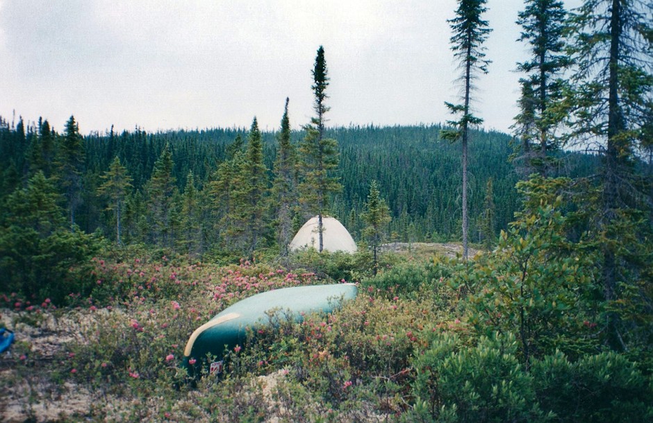
Well, sleeping on a rock in a bog isn’t as much fun as it sounds. To top it off, it was incredibly windy all night. Unable to use stakes, we were lucky we had all of our packs in the tent with us. We slept maybe three hours and woke up unbelievably stiff. The weather quickly cleared however, and before long it was sunny and hot. There were five or six rapids today and we managed to run them all. Not carrying our gear through the bush was a welcome change. We found a great site in the mid-afternoon so we decided to stop early. This site was like a tiny little paradise in the peat bog. It was a small sandy beach about 15 feet long. The fact that the pile of sand the tent was set up on was a giant anthill didn’t deter us for a second. This was the best site we’d had yet. We could finally bathe and put out our things to dry.
We plan our trips in six-day cycles, and this was our sixth day. By organizing our food in bags with six days worth in each, we ensure that everything is easy to find. More importantly, if before the end of a six-day cycle we realize we are low on food, then we can just suffer a bit, and wait for our next fully stocked six-day cycle of food. This is much better than running out of food on the 20th day of a 24-day trip. Today was a perfect day to get all of our food for the sixth to twelfth days of our trip organized.
July 18
This was the first day that had absolutely no rain at all (until 11:30PM when it started again). We paddled about 15 km to the first rapid, which involved an easy portage over the rocks, and a thrilling run through the last half of it. We then paddled through Lake Bardeliere, one of the larger lakes of our trip, which was eerily calm. Happy to make good time on the big water, we ran two more sets of rapids and ended up on a little island about 8km from the last rapid. It was a funny site. The island was only about 30 feet in diameter and covered with thick bush except for a small clearing in the center. Although there was no wind, there were no bugs at all. I don’t know how we found the site in the first place, but with the paucity of sites on the river we were looking everywhere.
July 19
We spent most of the day lake paddling against wind and wave. It was really very cold all day, even after it cleared up later in the afternoon. We managed to paddle to a site on an island well into another of the large lakes on our trip, Mesgouez Lake. This site was on a beach with a little wooden table and even a plastic chair. There were also two tents just down the lake a little ways. This was the first sign of people we had seen.
July 20
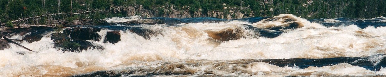
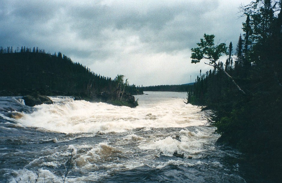
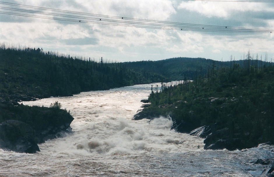
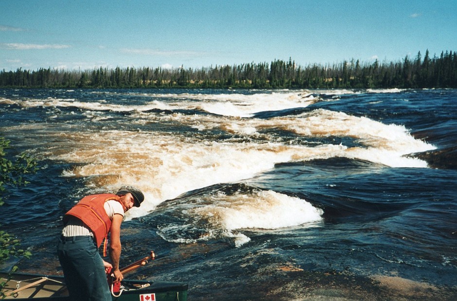
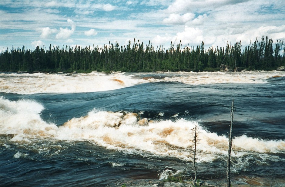
My journal for today begins as follows, “I can’t imagine where to start. Holy shit”. It was a beautiful sunny day and we were on the water early. We paddled to the first set of rapids, and scouted the start of them as best we could from shore. They looked like something we could do, so we paddled back and lined the canoe up with the flat dark water that flowed along the left side of the river into some minor white turbulence at the bottom. What we didn’t realize at the time was that at Mesgouez Lake, all of the various channels of water that made up the Rupert came together. The Rupert left the lake as one river, an order of magnitude larger than what we had been paddling in before the lake. It was not at all obvious that the river now had so much more power.
We were already in the “flat” dark water that led to the rapids before we realized how much trouble we were in. The dark water that we were coasting down was actually huge swells that rose up beside the canoe, dwarfing it between peaks. We didn’t want to imagine what it would be like when it got rough. We floated through these swells until we reached a point where we had to decide between an obvious V to the right, or an obstacle course through the boulders on the left. As what seemed like a random decision, I chose left. We managed to maneuver our way through and reached shore, taking on surprisingly little water. From the safety of shore we could see that if we had chosen the V on the right, we would have been forced over a huge drop into rocks and curling water. I think it is very unlikely we would have survived it.
We portaged the rest of the rapid and decided that we would have to be extremely careful from now on. However we didn’t even get through the morning before the next close call. Only a few kilometers down the river we had to choose between running a rapid on the south end of an island, or paddling a kilometer or so further to run the rapid at the far end of the island. Since we came to the south end first, we ran it. This was a very lucky choice. If we had run the rapid at the north end of the island, we would have been carried unknowingly into the deceptively calm looking water above a huge falls that was just around the corner. This time the choice that saved us was 100% luck. This falls wasn’t even on our map. We managed to paddle to shore and found a portage trail that required a Cree guide and a chainsaw to follow, and to our surprise there were three guys in little kayak playboats at the beginning of it. Apparently the “route de nord”, a 400km gravel highway that we would be crossing the next day, was close by. Even in their little playboats they could only run the smaller rapids at the side of the river.
We continued on to the next rapids where we stopped on a small island next to the right shore to scout. We were a little paranoid about the size of the rapids now, so we decided not to run them. Instead we paddled down the tiny bit of overflow from the river that went around the right side of the island. I couldn’t believe we misjudged this. The river was so shallow that we almost had to get out of the canoe a few times, and we could see the calm water at the bottom of the rapids. The problem was that even though the river remained the same width, the majority of the water converged into the main channel that we were following. We went over a couple of surprisingly big waves and then dropped into a huge hole. The curling wave at the bottom of the hole stood the canoe almost on end. We broke through however, and paddled hard in a futile attempt to keep the water filled canoe going in a straight line through the remainder of the rapids. We did somehow manage to keep upright and get to shore. After bailing and shaking our heads a lot, we paddled to our fourth rapid of the day. This one we ran as though the canoe was floating on sulfuric acid. We paddled for quite a while longer looking for a site, and eventually found one at the top of a 20 foot sand embankment. We ate and quickly went to sleep, mentally exhausted.
July 21
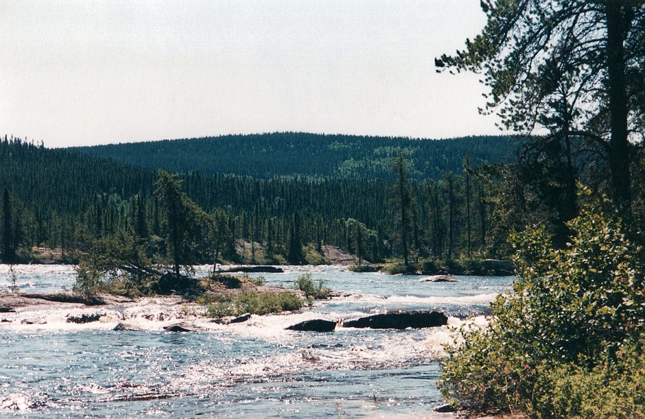
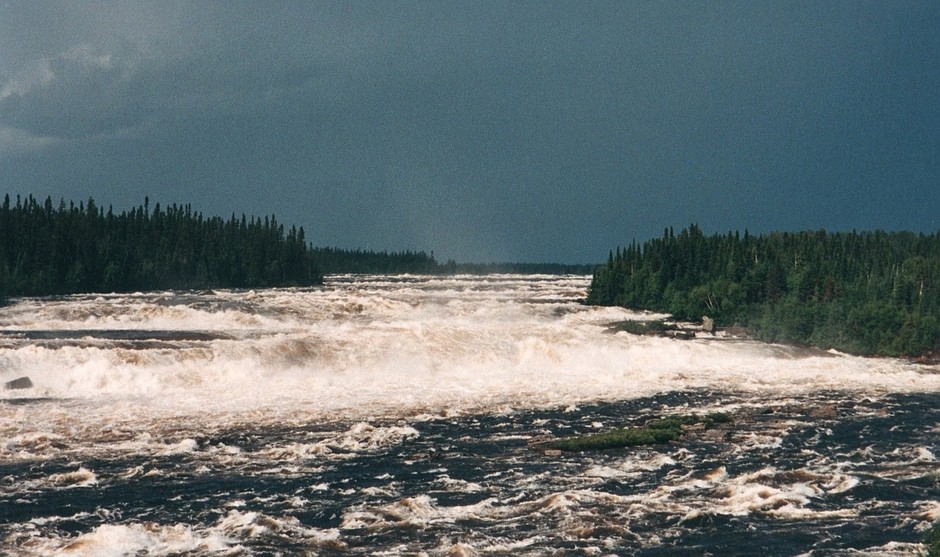
Looking from the “route de nord”
We weren’t in the highest of spirits today. It rained all morning and we portaged the only two rapids we passed. The second ones we might have been able to run but I just wasn’t in the mood. We reached “route de nord” where there is a rest stop with boardwalks that overlook the massive series of rapids and falls that the Rupert River had become. There were two couples in campers stopping for the night who gave us ham sandwiches and cold beer. The rapids go for as far as the eye can see, and after a fair bit of looking around, we found a trail that lead to the bottom of them. This would be our first portage for tomorrow.
July 22
The portage from the rest stop was quite long, but it was fairly novel to have a good trail to follow. Unfortunately we could only paddle about 100 meters from the end of it before we had to get out again. This portage wasn’t so nice. It was a long treed boulder field. Alex is the one who carries the canoe, while I carry most of the rest of our stuff. There is very little that Alex hates more than hopping from boulder to boulder with a 90lb canoe over his head. We reached the end however, just to paddle a short stretch of rapids before having to get out and walk again. We then put in at the bottom of the rapids to run the last stretch, and promptly swamped the canoe. The worst part about this was that my hat floated away never to be seen again. We bailed the canoe and found a place to camp. It was windy and sunny so we managed to dry everything out quite well. We had only gone about 7km, but since most of that was walking we tried not to feel too bad about it.
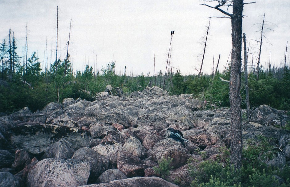
The boulder portage
July 23
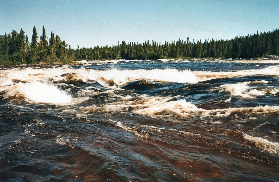
The rapids are getting unbelievably big. We passed three sets today, only able to run a short side channel at the end of one of them, and even that was questionable. It was a nice day though and we were able to eat a lot of blue berries along the portage trail. After searching for a site for a long time we finally found one on a beach, too late to take advantage of the sun.
July 24
We woke up to our third sunny day in a row. It was the start of another of our six-day cycles and we bathed in the river and organized our packs. The weather quickly became cloudy however, with off and on rain. The river changed as well. We had no rapids at all, and the shores were sandy for most of the day before becoming swampy for the last 10 or 15 km. We ended the day where the river thinned and the rapids began again. It looked as though this place had been used as a site before, and in the mud I found an old hat. What a lucky break. What the river taketh away the river giveth.
July 25
After portaging the rapids beside our site, we paddled five or six kilometers to the next set of rapids. There were two broken aluminum boats on shore, making the portage trail easy to find. We took the trail, but part way along it forked. The map showed two sets of rapids as the river made a tight curve to the right. I figured that maybe the trail to the right would pass both rapids. So I took a pack and set off to the right. While I did that, Alex brought the rest of our stuff to the fork in the trail. The trail I followed was pretty bad at first, leading through a swampy area for five or six hundred meters. After trudging through this I followed the trail further, until it ended at hydro towers. This is one disadvantage of canoeing anywhere in the area of Quebec that flows into James Bay. Periodically the landscape is blighted with huge hydro towers. I had already walked quite a way, so I followed the hydro towers down to the river and left my pack by the rivers edge. When I came back, sweating and muddy, I found Alex feasting on blueberries and relaxing. My choice of trails wasn’t the best one. We continued along the other trail and soon came to the river. We paddled what was left of the rapids, stopping to pick up the pack at the hydro towers.
It wasn’t much past these rapids that we reached Nemiscau Lake. I don’t know what Nemiscau means in Cree, but it should mean swamp. The shores are all swamp and there are numerous islands of swamp all through the lake. Keeping track of exactly where you are is nearly impossible since very few of the islands are on the map and the solid shores of the lake are too far from the open water to see. We paddled a long way through the lake and eventually came to an island with a rocky outcropping where we made camp.
July 26
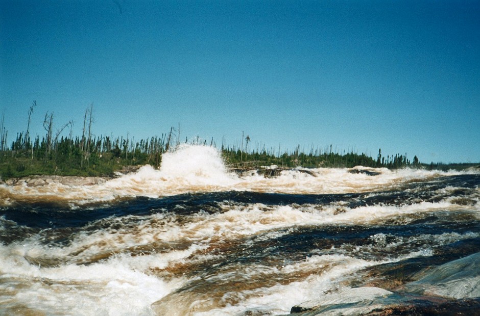
It was a very hot sunny day and we paddled to the end of Nemiscau Lake on calm waters. As the water from the lake became a river again there was a large set of rapids that split around an island. We paddled along the west shore of the large bay that lead to the river, to the “point of no return” above the rapids. Walking along shore we found that these rapids were an enormous series of ledges that went on around the corner as far as we could see. It would have been a ridiculous portage so we decided to check the east shore, which looked better. We paddled up the shore of the bay for at least 500m and then started across. It wasn’t until we were nearly half way across that we realized there was a strong current, and we were moving towards the rapids at an ever accelerating pace. In the middle of a large bay it is difficult to tell if you are moving because there are no reference points. If the shore is a few hundred meters away you can’t see your motion relative to it unless you are moving quite fast. We had no choice but to turn back. We pointed the canoe towards the open lake and paddled hard, trying to ferry back to the west shore. As the current pushed us, both the top of the rapids and the west shore were approaching quickly. I tried to optimize the angle of the canoe but it was difficult to know which would happen first, would we hit shore or go into the rapids? We luckily slammed into shore at the very “point of no return” where we had stopped to scout originally. This time we paddled up the shore a kilometer or so, right out of the bay altogether, before attempting to cross to the east side. We paddled with a wary eye on shore, even though it seemed ridiculous that there would be a current in the middle of this huge lake. We reached the other side where there was a portage around a series of rapids, and then a short paddle to a beautiful falls. This lead into a series of Class III rapids, which we ran. This was not an easy lake to get out of.
From “lightning rock”
Along the stretch of river below the lake we saw our second Golden Eagle of the trip. These are really magnificent birds to see in the wild. We paddled along the river for a while longer, as usual unable to find a site. It was getting dark when we could see another set of rapids coming up, so we settled on the best site we had seen. It was on a high rock embankment, the highest one around as a matter of fact, that had been burnt bare by a fire. There were unlimited blueberries, a full moon, as well as a nice view of the next rapids. As we were eating, there were two Nighthawks diving around our camp like jetfighters. Aesthetically a really nice site. Although the night was clear, we watched almost non-stop lightning from two clouds way off in the distance. So it was with some trepidation that we climbed into the tent and went to sleep.
Several hours later we were awoken by loud bursts of thunder and powerful winds. There were gusts from all directions, blowing the tent down against our bodies, first one way and then another. The wind was so bad that Al suggested that we get our raingear on in case the tent was ripped apart. As we did this, the lightning got closer and more frequent, and the thunder got louder. We made the perhaps obvious decision to go down to the canoe instead of being on the highest point around sitting on a rock. We leaned the canoe on an embankment in the brush and sat under it until the storm had passed. Returning to the tent we still managed to get a reasonable, if not dry, nights sleep.
July 27
When we did finally get up it was a hot sunny day without a cloud in the sky. We lined, paddled and portaged the rapids we could see from our site, and then paddled a short distance to the next set of rapids. The only way around these rapids was through a burnt forest. The burnt trees were quite small and still standing, like giant black blades of grass. There was only a couple of feet between trees, and I found it exhausting pushing between trees in a zigzag pattern. I can’t imagine how Alex got through with the canoe.
With the portage done we could get a good look at the rapids. They just keep getting bigger. At one point the river was being forced into a channel under such pressure that you could stand at the side of the river only a few meters from a ten foot high wall of water rushing past at an incredible speed. It was like water coming out of a hose. We paddled through some fairly fast water to just before another set of rapids where we were stuck taking a site high on a rock again. We hoped it wouldn’t be a repeat performance of the night before, but there just wasn’t enough time to deal with the next rapids before dark.
July 28
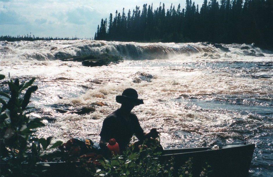
Well we got through the night without incident, and got on the water just before it started to rain. It wasn’t far to our take out point and we were confident we would get there today. There were a couple of small sets of rapids, which we ran, but mostly it was just moving water. By early afternoon, with mixed emotions, we had reached Hwy 109 where we had decided to take out. Although we had enough food along to go the 100 km further to Waskaganish we decided against it for two reasons. First of all there were an increasing number of rapids marked on our topo map between the highway and James Bay. At this point on the river, any rapids marked on the map translated into long portages with no trails. That’s fine in moderation, but it looked like we might be walking half the distance to James Bay. We didn’t really have the time or inclination for that. The second reason was that there are no roads out of Waskaganish and we had made no arrangements to get out. This would have ended up being either expensive, or a time consuming paddle down James Bay to Moosonee. So as we pulled out of the river we were excited to have made it, but disappointed since it seemed that we had cut our trip short.
Looking back on the Rupert from Highway 109
This did not mean that the adventure was over however, at least not for me. The next morning I still had to hitchhike up Hwy 109 and then along the gravel highway “route de nord” that we had paddled by a week before. After 400km or so it ended at Hwy 167 where I would have to get a ride north to Mistassini. Then I would have to drive the same route in reverse. Fortunately people are more sympathetic to hitchhikers on those remote roads than they are down south. After getting to the start of “route de nord” I had to wait for an hour before the first car passed. Even though they were going the opposite direction, they stopped. We chatted for a while and they said that a relative of theirs would be going the other way in the afternoon so I would get a ride eventually. Fortunately I didn’t have to wait that long. However I did wait two and a half hours before a car was finally going the direction I wanted to go. He picked me up, even though he didn’t speak a word of English, and we traveled in silence for the next five hours. By the next day I was back to pick Alex up, and we set off for the long drive home.