
The Kattawagami River and the James Bay Coast
-
Tales of Adventure
- Adventures on the Rupert River
- The Kattawagami River and the James Bay Coast
Kattawagami River and the James Bay Coast
as printed in Nastawgan: Autumn 2007 vol.34 No.3
The original article in Nastawgan can be found here.
When planning where to go for a canoe trip, I almost invariably start by pulling out an Ontario and a Quebec road map. I scan these vast areas, looking for rivers that stay away from roads and towns, yet have an accessible start and end point to keep costs down. I say “I” plan a canoe trip because when I go on a trip with my long time canoeing comrade Alex, all of the planning is left to me. Alex doesn’t participate in the planning process; he prefers not to know what I’ve gotten him into. I tell him the date, the province, and how long we will be gone for. He packs the stuff he’s responsible for, and I pack the stuff I’m responsible for. When the date comes we go. The date for 2002 was June 12. The river was the Kattawagami. If you look at an Ontario road map, you’ll see that the Kattawagami screams, “Paddle Me!” Highway 652 runs north out of Cochrane for about 100km where the paved road ends at Kattawagami Lake, which is the beginning of the river. The river then flows north where it eventually joins up with the Kesagami and flows into the Harricanaw, just before that river empties into James Bay. Heading west along the coast brings you to the Moose River, and a twenty kilometer paddle up the Moose brings you to the train station in Moosonee. The train is then a direct line back to Cochrane.
On the eleventh of June, we found our way to Cochrane, and spent the night at the campground in town, even though it wasn’t yet open for the season. For this trip, we decided to be extravagant and hired a fellow named Rick, who runs an equipment rental and car shuttle company called Coureurs de bois, to give us a lift to the start of the river. At about 8:45AM on the twelfth, Rick met us at the train station in Cochrane and we soon had our gear in his truck and were on our way. It was a straightforward drive and on route we were fortunate to see three bears, first a small one, and then a big sow with a cub. At the put in, Rick helped us to unload his truck, and it was a simple carry from the road down the embankment to the river.
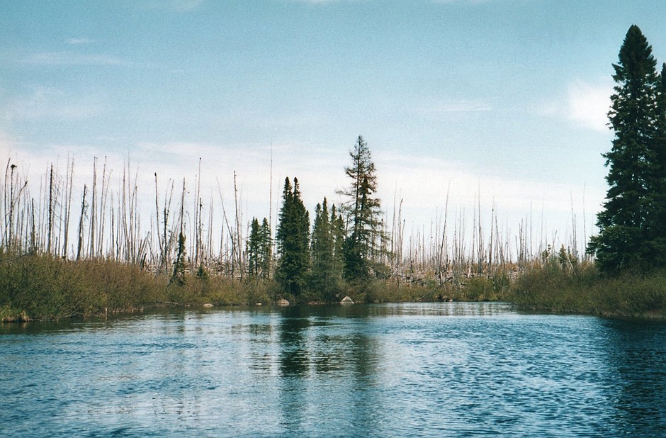
Although the river here was small, only about 35 feet in width, it was still much bigger than we had expected. We had heard that the few people that paddle this river usually fly into a small lake, called Bayley Lake, about 50 km downriver from where we were starting. I had visions that this 50km’s would be a tiny creek crowded with treefalls and boulders that we would have to struggle through for the first few days. That wasn’t the case at all. There was lots of water and quite a few rapids early on, mostly swifts and CI’s, but also a couple that were big enough that we felt the need to scout them. The water was really dirty and often the standing waves looked like rocks, making it difficult to read the river.
During this first fifty kilometers we also saw some wildlife. A beaver quickly dove underwater at our approach, and we came across two really large moose. An osprey was being chased by a bunch of smaller birds. There were dozens of Canadian Geese with young all along the river, always honking and splashing in an attempt to divert our attention from their young. The air was also filled with insects, mostly mayflies, which fluttered aimlessly over the water. Undesired wildlife was also plentiful. Whenever we stopped, the mosquitoes were horrendous, and they even annoyed us in a few areas as we paddled along the middle of the river.
The river had a fairly constant current and the shores were either swamp or so lumpy and covered in fallen black spruce trees that there was no hope of putting up a tent. Our first day on the river we paddled until 9:00PM, going to shore a number of times and walking up into the bush in the hopes of finding somewhere to camp. At 9:00PM we came across the best place we had seen so far. We had to move a lot of fallen trees, and it was lumpy and not actually big enough for the tent, but the moss and lichens made it quite soft to sleep on. Fortunately the days are long and it didn’t get completely dark out until almost 11:00PM.
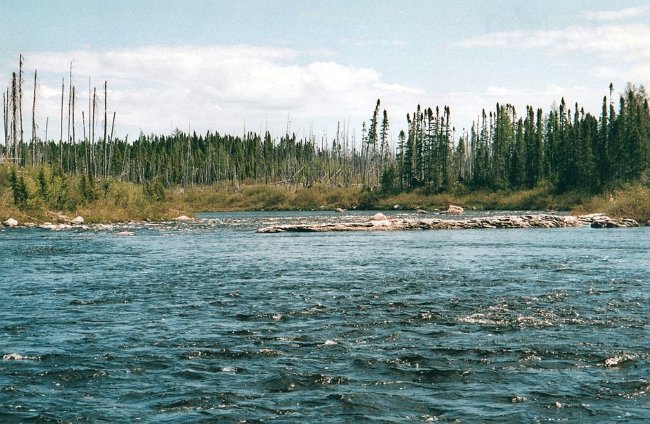
After Bayley Lake there were a number of swifts, but the river was generally wider and a bit more sluggish. The first rapid marked on our topo map was too big for us to run, but for the first time on the river so far there were rocky outcroppings, which made it straightforward to ease the canoe over the ledges. From these first rapids we paddled almost 10km, passing a few swifts and CI’s to the second set of rapids marked on the map. These rapids had a portage around them with a space for three tents at the start of it. They were all really bumpy, slanted, small spaces, but by far the best place to camp we had seen so far along the river, so we didn’t hesitate to stop for the day. Since Bayley Lake we had seen quite a few birds. Six osprey, every one of which was screaming at us, and a lot more geese with their young. We also saw three hawks.
June 14
From our campsite, the first section of the portage trail was only twenty-five meters or so long, where it put in just below a bit of a falls, leaving the rest of the rapids to be run. Beyond this the trail continued to the bottom of the rapids, but it didn’t appear to have seen very much traffic. By 9:30AM on a hot sunny morning, we had done the short portage and run the bottom section of the rapids. All day long we had rapids to run. There weren’t a lot of rapids shown on the map, but in between the ones shown were a lot of CI’s and a few CII’s. One of the rapids shown on the map was definitely a falls, and most of the other ones shown required careful scouting and often lining. There were so many rapids that at the end of the day it was hard to remember them all. We had problems finding a site again because there really wasn’t anywhere to set up. We didn’t stop today until after 8:00PM and this was on a shrubby outcropping where we had to chop down a lot of little shrubs and then lay down hemlock boughs to try to get the tent level, and to keep the underbrush from poking holes in it. Since the road we’ve paddled approximately 105 km’s. With all the lining and scouting this river is a lot of work to get down, even though there are almost no portages.
June 15
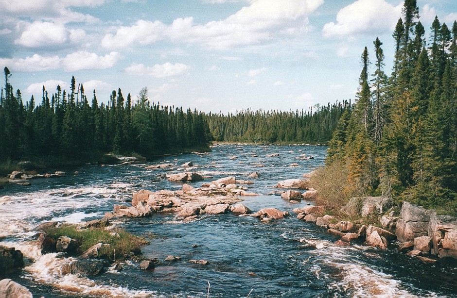
It was another hot sunny day, the weather has been great so far. Today was chock full of rapids. We passed nine that were marked on our topo map and couldn’t run a single one. They were all either too big to run, or had severe ledges, unless of course they had severe ledges AND were too big to run. Between the unrunnable rapids that are on the map, however, there are a large number of runnable rapids. There were none that we felt the need to scout, but a few of them would probably have been CIII’s and there were a lot of technical CIIs. Despite all of the rapids that we couldn’t run, we only had to do three portages all day, and these were just short walks along the bedrock shore. What we did spend most of our time doing was lining. It also took us a lot of time to figure out where the best place to line or portage was. In particular there was one place where the river turned into quite an impressive falls as it split into three around a pair of islands only to be followed by another pair of islands where the river split into three again. This made it incredibly difficult to judge which way to line and carry around them, since taking the easiest route around the first pair of islands could force us into taking the most difficult route around the second. After much time spent scouting each side of the river and the top pair of islands, we found a route that turned out to be just a short stretch of lining followed by a short easy portage.
In the early after noon, too early to think about stopping, we were passing an island where I had planned for us to stay that night. As we paddled by it I was telling Al that this was our planned stopping point, when along the shore we saw a big black bear walking through the alder bushes. He walked along the shore watching us with curiosity before turning and strolling into the woods. I’m glad we hadn’t set our hearts on stopping there. When we did stop at 6:00PM we had only traveled 10km total all day. It’s a good thing that our previous days had put us ahead of schedule, because the map shows even more rapids ahead.
June 16
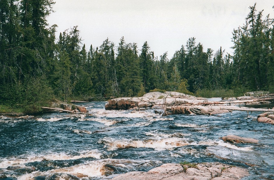
We were up early and at the next rapids right away. All day we never had more than 500 m between rapids. Of the more than 15 rapids on our map that we passed today we could only run maybe three. The rest, apart from two easy portages, we lined. Our lining is getting pretty creative. We lower the canoe full of gear over three foot drops, or run along beside the canoe as it cascades down in four inches of water over the smooth bedrock. A few times we slid the canoe out of the rapids and “lined” the fully loaded canoe down ten or fifteen feet of dry rock to avoid stretches where the water was to tough to line. We would use the bailer to wet the rocks before pulling the canoe onto the shore, but even so, only Royalex would have withstood such abuse. At one set of rapids the only reasonable way to get around them was to line through a little “creek” that broke away from the main river and through the trees before meeting up with the main channel again below. It was very fast moving and rocky, and trees were hanging over it making it necessary to pass the rope from one hand to the other around their trunks as we made our way downstream. I sat laughing as Al, who was controlling the rope at the front of the canoe, spent ten minutes attempting to throw the rope to himself around the trunk of an old cedar that must have had a ten foot circumference. Eventually he got it, and after some more hard work and wet feet we reached the main channel.
It was a sort of grey rainy day, but it didn’t end up raining very much in the end. We made camp on a rock about thirty feet up from the river at about 6:30. Although the river is very rocky, it is surrounded by swamp. Apart from our second night’s site, we haven’t seen any real campsites. In fact the only signs that people have been here at all, is a few scrapes of red and blue paint on some of the same rocks that we pull the canoe over. So I suppose at least two canoes must have been here ahead of us, but where they camped I have no idea.
June 17
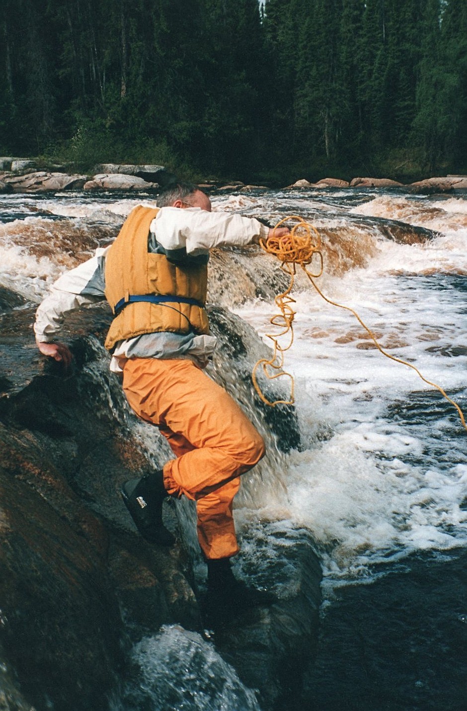
It was a good thing we stopped yesterday when we did. This morning, just past our site we came to two sets of rapids, one right after the other, that were the most convoluted and complicated of any so far. We spent ages going from side to side of the river and bushwhacking around different islands trying to figure out what route to take without getting ourselves committed to a route that we would regret. We finally decided on lining through a shallow steep section on the far side of an island. I think we chose the best route, but it had taken us a long time to decide on it. The rest of the day didn’t go much quicker, as we were constantly in and out of the canoe, over and over, and there were a lot more carries than there were yesterday (where we have to unload the canoe and carry everything a few meters, just to load it back in the canoe again-not really long enough to call a portage). There were even two short trails to follow, although they didn’t look like they got much use. We also passed an actual campsite that people had used, but it seemed very small for our big tent and as it was only 6:00PM so we kept going. At the site I did find a waterproof map bag with some faded maps in it. I hope no one was relying on those.
We ended up camping at the start of a short carry on some moss covered rocks. We’ve lost track of where we are exactly. With the constant rapids it makes it difficult to distinguish one from the next and we never seem to make time to pay attention to the map when we’re so busy. We must be fairly close to the end of the rapids though. Both of our hands are in pretty bad shape, with cracks and blisters from all the lining we’ve been doing. So a break from the lining might be nice.
Most of the day today it was rainy, but it was very calm and the sun was out sometimes. From our site we saw a fantastic double rainbow, one of which had very distinct strips of color and seemed to come down right to the water. You could see it on the trees on the far shore. We were going to cross over and look for the pot of gold, but even if we found it, who the hell wants to portage it.
June 18
Well we got to the end of the intense rapids section of the river. The numerous rapids along this river have been a lot of fun, even though we end up lining most of them. There is a lot of time spent figuring out where to run/line/portage the river and it’s interesting to see how creative you can get. I don’t know if these few days of intense rapids would be much fun on a guided trip however. If someone knew the river and told you exactly where to get in and out, I think you would start to feel like a member of a chain gang, slaving away all day with very little time actually spent in the canoe.
This morning there were a few big falls to portage and line, and we ran a few good runs, when quite suddenly it began to look like James Bay Lowlands. The shores are clay and scattered with boulders, until you paddle for a while and the boulders start to disappear. It looks a lot like the Missinaibi River does after you get through the gorge below Thunderhouse Falls.
Even on the lowlands the river has a pretty good current, and we made good progress despite the fact that we were still negotiating rapids on the shield after 3:00PM. It was hot and sunny all day and the bugs weren’t bad at all for a change. When we got to our site however, the mosquitoes were worse than they had been all trip. The banks are soft clay with grasses up to the forest edge. We continued paddling for a long time before settling on a spot to camp at about 8:30. Over the last few days we have seen numerous osprey, one pair circling around their nest high in a tree on an island. We also saw a skunk digging in the soft ground along the edge of the river.
June 19
Late in the night, when a full bladder prompted me to go outside, the sky was clear and filled with white streaky northern lights. It was a treat since I don’t usually stay up into the night, and so don’t get to see them very often.
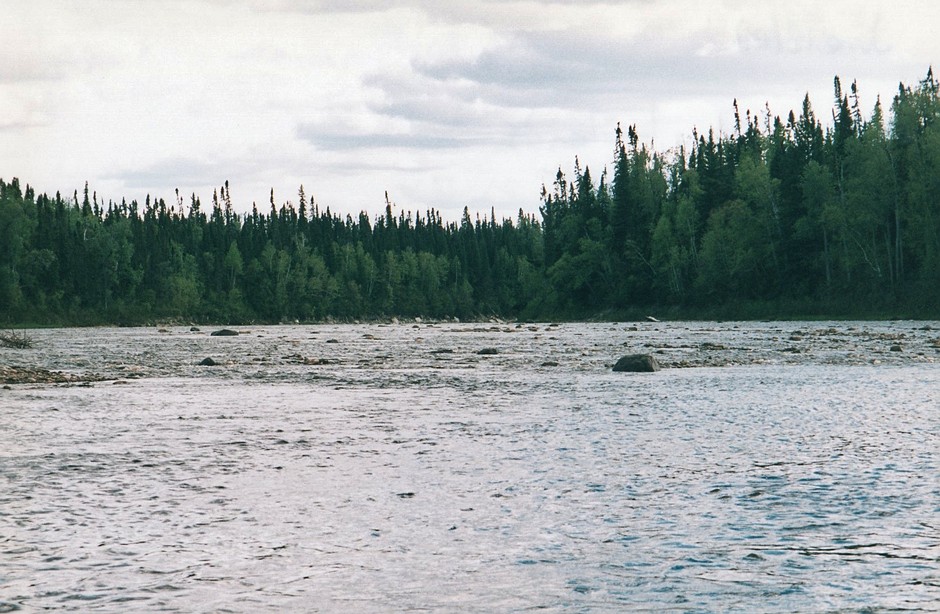
The start of James Bay lowlands
In the morning it was hot and sunny with not a cloud in the sky. We paddled the short distance in a slow indifferent current to where the Kattawagami meets the Kasagami River. We stopped where the rivers met and filled up with about 15 liters of water, not knowing what to expect on James Bay. Along the river we spotted a marten, and we also came across two young moose. They allowed us to paddle quite close to them, but then when they did run into the bush they went so fast that they left behind five or six moose flies, which buzzed around us for a while in confusion. It had been windy all afternoon, but when we got to the clay shoals where the Harricana empties into James Bay the wind picked up significantly. It was about 1:00PM and it appeared that it had just recently been high tide. Over lunch we tried to figure out how we would go about our paddle to Moosonee along the James Bay Coast. We had never dealt with tides before and knew we had to come up with a strategy.
About half way between our location at the mouth of the Harricana, and the mouth of the Moose River, is Netitishi Point. Although there were no contour lines shown on the map, we figured that this must be a relatively high spot, since there appeared to be very little difference in the size of the shoals between high tide and low tide. Low tide at any other place along the coast creates shoals that go literally kilometers out from shore. Also, at thirty kilometers along the coast, Netitishi Point seemed like a perfect goal for one days paddle.
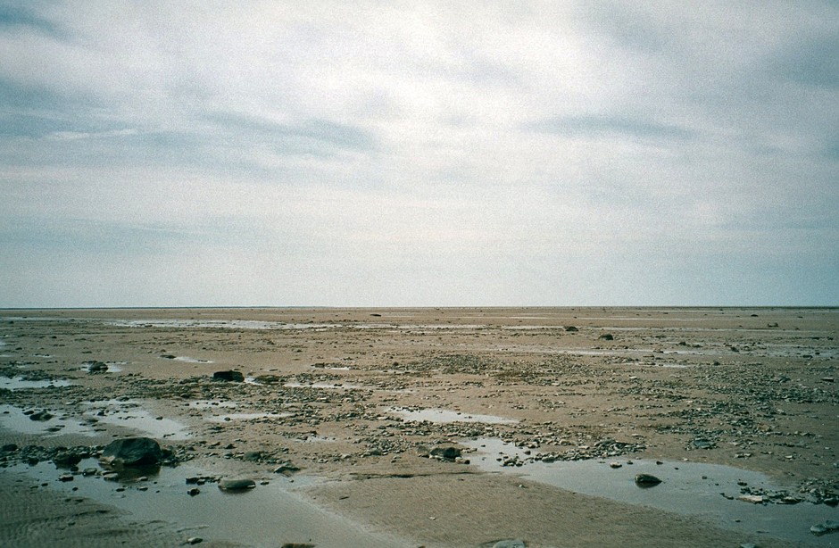
With the tide out, the ocean disappears
Although the shoals are less significant at the Point, we still didn’t know what to expect, so we wanted to arrive at the Point at high tide to avoid carrying all of our gear and canoe through the mud when we landed. Since high tide seemed to be at around noon, we figured that the next high tide would be at around midnight. So if we left after we ate lunch, we would want to arrive at Netitishi Point around then. This didn’t seem like a great plan on a windy day, so we figured that we would try to be ready to go by 4:00AM the next morning, when it started to get light. Unlike on the Bay itself, on the river the tide only goes out twenty or thirty feet, so we could launch at whatever time we wanted.
Now that we had the day off, we had a lot of time to look around. The conifer trees have all but gone, and there are only poplars and willows along the shores. Where we are now is mostly open field with sparse four foot high willows. It’s very windy and we are quite exposed, so I hope that no bad weather blows in. The shoals really are big. When the tide is out the bay is just a field of clay. We can’t even see the water in the distance. We walked around on the shoals for a bit, and at least around here the clay seems pretty solid, we don’t really sink into the mud at all. At 6:00PM, lying in the tent writing in my journal, it is so hot, that I feel almost sick. Even though it is still sunny we are going to try to get some sleep before 2:30 rolls around and it’s time to get up. At least we have a plan.
June 20
We were up at 2:30 and on the water just after 4:00. We put our homemade three quarter canoe cover on the canoe, and wetsuits on ourselves, preparing for the unknown. It was still hot, and really windy. At low tide, which it was pretty close to, the river flows between shoals that continue beyond the actual mouth of the river for about 7km. This is where all of the sediments that come down the Harricana settle. We would have to paddle out and around this before we could paddle west along the coast.
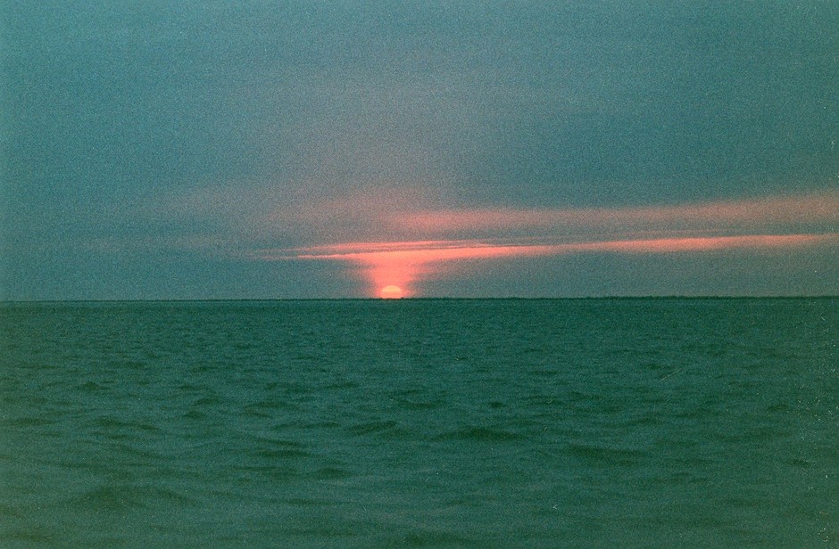
Sunrise at 4:30 or 5:00AM
We raced along the edge of the shoal, thanks to a strong tailwind, covering several kilometers in no time. When we looked back we couldn’t see the true shore anymore, just clay tidal flats as far as the eye could see. Then quite suddenly, the skies grew black and the wind picked up as it started to pour with rain. We were extremely worried about lightning. If there was lightning, there would be nothing taller than us in any direction for miles. I don’t know what we could do, just hope we were lucky I guess. We were also a little worried that the tide might come in quickly, leaving us in the middle of nowhere, with no land around and a strong wind heading out to sea. We reluctantly decided that we had to turn back.
It was a brutal paddle back, it was pouring like crazy with a powerful wind kicking up big choppy waves. The fear of lightning was rattling my nerves. As far as paddling the rough water itself was concerned, the reassuring thing was that the water was shallow, and at any time we could get out of the canoe. The scary part about that, was that standing tall on shore was the last place you wanted to be. The worst seemed to pass and we could see clouds again. We stopped on the shoal to decide if it was just a passing storm cloud, but the distance was just a grey haze, and we didn’t think it was a good idea to continue. The winds heading back were still brutal and it took a couple of hours just to paddle back to where we had started from. We decided to continue eight kilometers up the Harricana to Goose Camp. This is where a lot of people finish their trips down the Kattawagami, Kasagami, and Harricana rivers, to await a shuttle out. We didn’t really have a plan from there, but figured we could talk to someone and find out if these relentless winds ever let up.
It was a long eight kilometers into the wind, but eventually we dragged the canoe up the shore to have a look around. There was an impressive two story log building, a chalet I guess you would call it, nearly finished being built. It looked as though the building process had been taking years, but it didn’t seem very far from being completed. This new looking building had a couple of windows wide open and the front door was open and blowing in the wind. The grounds were quite a mess, with junk piled all over the place. Beside the new chalet was a more modest wooden building that was obviously the building that was used. A sign on the door read “please remove your shoes”. So we removed our shoes and made ourselves at home. From the magazines laying around, and a journal that was left on the kitchen table, it was clear that no one had been here since last season. The cabin had four large bedrooms and a big central kitchen and dining area. Although we were out on the water for almost six hours, it was only 10AM, so we had all day to kill. We mostly just hung around and read old articles of Time, Macleans, and Readers Digest that were laying around, but it was nice to be sitting comfortably on chairs. The weather cleared up a bit during the course of the day but the persistent wind didn’t let up. Our plan for tomorrow is to leave at around 9AM, so that we get to the mouth of the Harricana at about 10:00AM. High tide will likely be closer to noon but with any luck we can sneak around the corner past the shoals without going to far out. Hopefully the weather will improve.
June 21
Last night we had a pretty bad sleep. We were excited about being able to sleep on beds, but as soon as it got dark the mosquitoes started to fill the bedroom, and we ended up having to sleep in our bug jackets. It would have been more comfortable in the tent without the all night buzzing. We got everything packed up and into the canoe by 9:00AM as planned. The power of yesterday’s winds became apparent to us as we walked down to the canoe. Another door had blown open in the chalet (we closed the doors before we left) and a hand carved wooden chair with a big W on the back that was sitting out overlooking the river had blown over. That chair had to have been sitting there since the previous fall without blowing over, so the winds must have been particularly bad. This morning the wind was nowhere near as strong as it had been, but now it was blowing in off the bay, giving us a headwind. With the high tide coming in as well, it was a lot of work just to get to the mouth of the river. The bit of extra time it took us put us at the bay when the tide was quite high, and we could cut across the shoal without any problem. It was a beautiful day for paddling. There were virtually no clouds, and once we were out on the bay there was only a slight breeze blowing in towards land.
Paddling in the bay took some getting used to. The water gets deeper so gradually that we needed to stay what must have been about a kilometer out from shore in order to keep just enough water under us to paddle. I don’t know if it was us creeping in or the tide going out, but it always seemed that we had to paddle at about a thirty degree angle away from shore if we wanted to avoid having our paddles start hitting bottom.
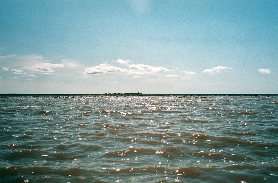
Looking back towards the small island as we worked our way around it.
About 20 km along the coast there is a small island that is about 3km from shore. With the clear blue skies we could see this island from quite a distance, and we soon realized that there was no water between it and the land. The tide was already low and going out further. Paddling around the outside of it seemed to take forever. The tide was out far enough that there was land for over a kilometer beyond the island. The shoal was littered with rocks, many of which were several feet in diameter. We originally tried to keep a minimal depth of water underneath us, but kept getting tied up in the rocks and uneven ground that surrounded the island. This forced us to paddle far outside the edge of the shoal. At our furthest point we must have been actually paddling at least six kilometers from the true shore. It certainly seemed like a long detour at the time.
After we got to the far side of the island the paddling became much more straightforward, as we cut on an angle back towards shore. This gave us probably five or six kilometers across what is called Hannah Bay, in water that for the first time was deep enough that we couldn’t touch bottom. We continued along shore for a couple of more kilometers to Netitishi Point, which is where we had planned to stop. It was 6:00PM and the tide seemed low, which left Netitishi Point quite a distance across the shoals. We had not been out of the canoe since we started paddling nine hours before, and had only eaten a chocolate bar and nuts and raisins all day. But the air was still and the sun was blazing in the sky. When would we get another perfect day like this? After a brief discussion we decided to continue on. We didn’t want to take a chance that there would be a change in the weather well we still had some of James Bay to paddle.
The mouth of the Moose River was about 20 km away as the crow flies (Oh to be a crow). Al was happy to just continue on uninterrupted, but for my psychological health I wanted to stand up on land for a minute. So we got out in a few inches of water, and had some nuts and raisins as we walked, pushing the canoe along shore at a leisurely pace. Although we only walked for five minutes, it felt good. It was like we were heading out anew.
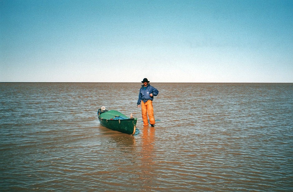
A five minute break
The shoals around the Moose River are much bigger than those around the Harricana. The map has them extending about 10 km beyond the mouth of the river. So our paddling brought us gradually further and further away from shore. After several hours paddling it was beginning to get dark, and we were getting worried that we wouldn’t even be able to see the mouth of the river from so far away. The trees on shore made only a thin line along the horizon. We were fortunate in that it was the longest day of the year, but when the sun went down at around 10:00PM we still hadn’t seen the mouth of the Moose, or found any deep water that would lead us there. Shortly after the sun dropped behind the horizon however, we could see a break in the thin line of trees in the distance. Keeping tight to shore, a channel eventually opened up and we were heading towards land.
The night was beautiful. Directly to our right, behind what really looked like the edge of the world, the sun’s glow painted the horizon red. And to our left, the almost full moon shone a bright white light in an empty sky that seemed to stretch forever. After paddling some distance between these enchanted shoals, the silence was broken by what must have been a small army of geese, honking incessantly. At one point I saw something large surface briefly about fifteen feet from the canoe. A seal? A Beluga whale? My tired mind playing tricks in the dark?
Although it was a beautiful night, the ten or so kilometers we had to paddle between the shoals to reach the mouth seemed long. We had lost track of whether the tide was going in or out, but the Moose River has a strong current, and there was no reason to think that the current would stop as it ran between the shoals. When we did finally get to the mouth, we stopped on Ship Sands Island. This was actual land with trees and everything! We stretched our legs and had some more nuts, but there was no stopping us now. In the morning there would be a train leaving Moosonee for Cochrane. If we didn’t make that train it would be a three day wait for the next one. Moosonee was still twenty kilometers upriver, but this time “as the crow flies” wasn’t so far off the truth. We climbed back into the canoe after our only second five minute break of the day and started upriver. Just a short distance up the river we could see some lights on a tower in Moosonee or Moose Factory. This made it seem close. Lights are deceiving that way however. You paddle and paddle and they just don’t get any closer. It seemed to take forever.
When we finally did reach the edge of town, Al was inspired to paddle full out for the last stretch, and of course I had to keep time. The part of town that we had to get to was a lot further away than I think he envisioned, and we pumped away like maniacs for what must have been fifteen minutes. But we had made it. The moon was just setting as we stumbled onto shore at 3:30 or 4:00AM.
While Al portaged the canoe through the quiet streets of Moosonee to the train station, I carried all of our packs up the embankment to the side of the road. Luckily Al ran into the OPP officer on duty, who gave us and our packs a drive up to the station. In no time we were laying on the asphalt next to the train, with only a few hours to kill until we left for Cochrane.
