Algonquin to Adirondacks
Chasing the Moose
Cycling the Canadian Section of the Algonquin to Adirondacks Corridor
The Algonquin to Adirondacks Initiative is an effort to develop a wildlife corridor across the Algonquin to Adirondacks region. This work is being undertaken by a group of concerned citizens and organizations officially known as the Algonquin to Adirondacks Collaborative. For more information on the great work they’re doing, visit their website. I won’t discuss their work, other than to quote the inspiration for the initiative from their website:
“A2A's animal inspiration is a 700-pound female moose that was collared and released into the Huntington Wildlife Forest, in New York's Adirondack Park, in 1998. "Alice," as she was named by her researcher-guardians, also travelled for two years, leaving her home park in 2000 and heading for the Canada-U.S. border. That spring, she became a Canadian citizen when she swam across the St. Lawrence River (and walked across Ontario's four-lane Hwy. 401). By winter, Alice had crossed into Algonquin Provincial Park, completing a journey that spanned 570 km and an international border. Her remains were found in 2001, in Algonquin's eastern end; she died of unknown causes. Like many creatures before her, Alice demonstrated the need for connected pathways for wildlife to roam. By walking A2A, Alice proved how critical this linkage could be to migrating wildlife — and called us to action in protecting and restoring it, so other roaming wildlife might follow in her footsteps.”
As part of the establishment of this wildlife corridor, an A2A trail has been identified as a priority initiative by the A2A Collaborative. The trail is still in its planning stages, and only had its first reconnaissance trek/cycle in the fall of 2017. In May of 2018 I decided that I would attempt to scout a cycling route on the Canadian portion of the proposed A2A trail and record my thoughts as this journal.
I began my trip at the start of the trail at the Algonquin Visitor Centre, and cycled to the Thousand Islands International bridge on the St Lawrence River. I have only focused on the potential for a cycle route along this corridor, and have left aside the fact that the trail(s) is(are) also planned for hiking/multi-use. A list of my recommendations follows this trip account. I have also included a brief description of the route I ended up following at the end of this journal.
I would like to make clear that I have no affiliation with the A2A Collaborative and did not undertake this in any official capacity. I’ve followed their work for some time and am inspired by the idea of an A2A trail. The folks at the A2A Collaborative kindly provided me with maps of the route(s) being considered at the time of my trip and answered any questions I had about the route. The trip and my comments here are entirely my own. By not having any knowledge of the discussions or reasoning of the Collaborative I hope that I can provide an outsider’s impression of the potential of a cycle route along this corridor.
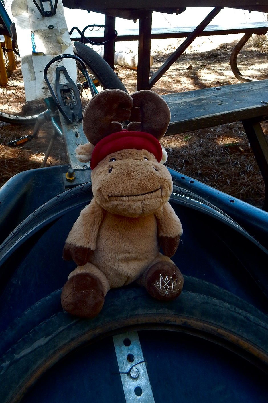
See Alices impressions of her week scoping an A2A cycle route.
Arrival - Algonquin Park May 13, 2018
There are still small piles of snow here and there when Alice and I are dropped off at Mew Lake campground... It’s a beautiful sunny day and the sun is hot, though the air is still cool. Maybe 10 or 12 degrees. The forecast looks fantastic, with sunny skies and warmer temperatures for the next week. The leaves are just starting to come out on some of the deciduous trees, but surrounded by huge white pines, spruces, and balsam fir, the forest around Mew Lake is all green. It’s great habitat for a moose, and perhaps not surprising that Alice found her way up here. What is perhaps surprising is that she was able to make it this far.
All animals need to move around. As their populations naturally expand and contract, some animals are forced to move from where they are born, just as years later their descendants may be forced to return. More importantly, any species needs to intermix its genes outside of its own local population from time to time. This is why protected areas, which are essential to the survival of many species, are not usually sufficient to protect those species over the long term. Corridors of suitable habitat between protected areas are critical so that individuals can move between them. This is particularly important given the drastic changes that are occurring because of climate change. Many species will need to gradually migrate north or face extinction. This is what the A2A initiative is all about. From the Adirondacks in New York State, there is a great corridor for wildlife if they head to the south,which runs along the Appalachian Mountains roughly following the Appalachian Trail all the way into Georgia. Likewise, north from Algonquin Park, despite the resource extraction that takes place, the land is mostly forested with many places for wildlife to make their way all the way to the treeline and beyond. The area between the Adirondacks and Algonquin Park, however, is a problem. This region is largely developed and is becoming more so all of the time. Yet much of it is still forested, and very rural, with farmland and open spaces which could still be easily maintained or modified into a place friendlier to wildlife. This however, will require action. If we just allow the status quo, this region will continue to be developed until there is no corridor at all.
So let’s do what we can to ensure that this wildlife corridor isn’t lost, but right now, let’s see what sort of bike route we’ve got here.
Day 1 - Mew Lake to Madawaska May 14, 2018
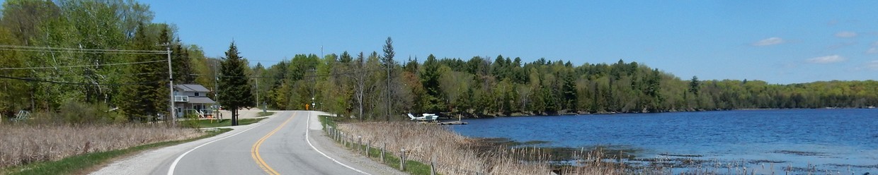
Algonquin Visitor Centre, is the official start (or end) of the A2A Trail. When wildlife from the east arrive here they’ve made it. Heading north from Highway 60, the lakes, rivers and forests can be followed almost unbroken until you reach the northern limit of trees.
Alice and I are beginning at Mew Lake Campground, which is just off the side of Highway 60 about 13km west of the Visitor Centre. This early in the year Mew Lake Campground is the closest open campground to the Visitor Centre. Later in the summer, there are a couple of campgrounds open that are closer to the Visitor Centre from where you could begin.
Within the Park, Highway 60 has a decent shoulder for riding, with some fairly significant hills, though they have relatively modest slopes. There happens to be construction right now, with 20 foot or so sections of gravel appearing quite regularly, where culverts have recently been replaced or added. I don’t mind the interruption in the smooth ride as the culverts appear to be local wildlife corridors of their own. Tens of thousands of animals are killed each year in Canada because they are forced to cross roads where culverts are either too small or are above the level of the water, so that many animals, like turtles, can’t climb into them to safely cross under the road. There would be almost no extra cost to installing culverts properly in the first place, but it’s difficult to get governments to make this simple change to the regulations governing road building. It’s great to see that they are remedying this situation along this stretch of Highway 60 though.
From the East Gate of the Park you lose your good shoulder to ride on. There’s a twelve-inch shoulder, not quite big enough to stay out of the traffic, all the way to Whitney. The Booth trail is about 19km from the Algonquin Visitor Centre and is easy to find just before the Mad Musher in Whitney. There are washrooms and picnic tables just across the road.
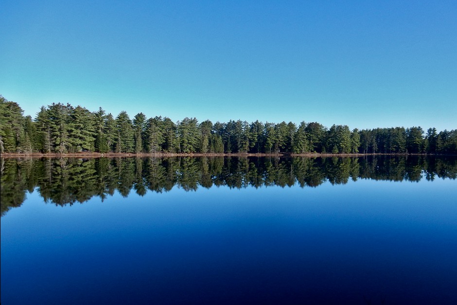
The Booth Rail Trail begins on soft sand - it’s extremely difficult to make any forward progress, if you can manage to stay on your bike at all. If you persevere however, you will be rewarded with occasional stretches of deep water that you must ride through, as the only break from the soft sand of the trail. I continued for 5km in this way, hoping it would improve. It did not, and I was forced to get off and push my bike in some parts. The trail itself is quite wide and rutted with ATV tracks, but the landscape is gorgeous. It pretty faithfully runs along the Madawaska River, which is extremely beautiful, and once you are a couple of kilometres in it is just wild forests. Clearly an excellent corridor for wildlife, but as it is now, it is not a realistic cycling route for most people. If you were looking for a challenging wilderness cycle trip however, it would be fantastic. My tires are slicks and I’m pulling a heavy trailer, but if you had knobby tires and were travelling lighter, it would be a very doable challenge. I think that few people would undertake it as part of a long distance cycle route though, unless substantial improvements were made. As a walking trail though it would be great, if you don’t mind getting your feet wet.
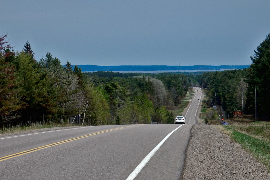
I had some lunch and struggled my way back to Whitney, retracing my steps. It was nice to be back on smooth pavement again, but when leaving Whitney you need to climb three enormous hills in succession. After that, climbing and descending more regular sized hills is the norm. There is quite a big shoulder leaving Whitney as you climb the big hills, but it then returns to the 12-inch shoulder, that only widens on occasion. The traffic volume is fairly light however, so it’s a nice ride through wilderness.
In Madawaska I stopped at the general store for ice cream, then continued a few hundred metres to Riverland Lodge and Camp. The store and check in were closed, but I was invited inside the large bed and breakfast building by a friendly old woman who informally checked me in. It really felt like a bear hunter’s lodge, and the bear theme was ever-present in the rambling wooden interior of the house. There was a large bear skin with head on the wall, and dozens of bear trinkets and bear related ornaments, not to mention the bear photos and a bureau with toy stuffed bears on it. The only variance from the bear theme was one hutch full of old china and Princess Diana plates.
As the camping wasn’t busy she told me to stay wherever I liked. There were many more or less permanent mobile homes around, with a number of people staying in them. Kids’ toys were scattered haphazardly around the grounds, a tattered Canadian flag was flying, and the neglected but very functional washrooms and laundry room completed the hunting lodge feel of the place. As the only tent, my site was very nice, on a bend of the river as it opens into a small lake with the Highway on the other side. Like the Booth Trail, the river has sandy shores and there is a nice beach. I sit on my rickety picnic table and can hear the song sparrows singing and the trill of frogs in the distance, punctuated by the occasional slap of a beaver’s tail.
Day 2 - Madawaska to Dore Lake May 15, 2018
It was much warmer in the night but it started to rain lightly very early in the morning. By the time I left it was almost 9:30 and it had stopped raining, though it was still very gray and damp. It stayed that way all morning, always looking as though it could rain at any moment.
It’s 27km from Madawaska to Barry’s Bay and the landscape continues to be wilderness, however it doesn’t have quite as wild a feel as it did before Madawaska. Some of the road has a slightly wider shoulder, maybe 2 feet wide, and the hills along this section are a bit less treacherous. I was very damp and cold in my rain gear so I stopped in Barry’s Bay for a warm breakfast and hot coffee. By the time I finished breakfast and warmed up it was noon.
The ten-kilometre ride from Barry’s Bay to Wilno along Highway 60 was busier and not fabulous to ride on, due to the increased traffic and only 12-inch shoulders. There are more houses, businesses and small farms along this section. At Wilno I turned at Wilno South Road (#66), which was a very steep hill that I actually had to push my bike up. This was followed by two more steep hills, though I managed to ride up those. I turned on Mountainview Road, which was more like hard pack than smooth pavement, but was fine for riding. I’m not sure what I did wrong, but I somehow found myself back on Highway 60 a little way before a picnic area that marks the first Polish Settlement in Canada. All of that climbing was for naught. Because I managed to lose my way, I didn’t see the whole section of this back road, so I don’t know how suitable it would be for cycling. I hope it is a good road because it would be nice to avoid Highway 60 on this stretch. In fact, since I don’t believe that any reasonable bike route would take the Booth Trail, it would be worth looking at turning off Highway 60 at Yantha Road to Concession 2 Rd, to get even more time on back roads and off of Highway 60. Some signage along these roads would be helpful as well if this were to be made part of the route.
I was happy to get off Highway 60 again once I reached Killaloe. Killaloe is a really nice-looking little town. For one it isn’t on the main highway, but more importantly it was the first town that I’ve come across that felt like a community instead of just a sprawl of houses along the highway with widely spaced stores selling different types of equipment.
Just beyond Killaloe I looked at the turnoff for the snowmobile trail that is being considered as part of the route, but chose not to take that way. I feel that the quiet country roads are preferable to an off-road trail that has not been maintained for cyclists at all. I instead took the #70 towards Ruby, which was a really nice ride through forests, and then a mix of farm and forest as you approach Ruby. This really nice ride continued up through the First Nations community of the Algonquins of Pikwàkanagàn as you approach Highway 60. Unfortunately, I did not continue along the back roads to Eganville, as the proper route indicates, as I had to take the detour up to Dore Lake to get to a campground. It was about ten terrible kilometres along Highway 60 with only about a six-inch shoulder and moderate traffic to the turnoff at Germanicus Road. Germanicus Road and Smith’s Bay Road were a nice but short ride to Smith’s Bay Campground on World Famous Dore Lake (so the sign says). It’s a neat, well organized park that is quite dense with trailers. A nice fellow, who smoked a pipe and seemed very sensible and practical, saw me ride in and showed me where the tents go. There was a very strong wind so he let me set up beside a small cottage, which no one was using this early in the year. The cottage was just a few metres from where the tents are supposed to go but it was a bit more sheltered by some trees and docks that were not yet in the water.
Day 3 - Dore Lake to Calabogie May 16, 2018
There was a bit of frost last night, but the day turned out to be warm and sunny. Once in Eganville I stayed on 41 across the river and continued past the first street on the left up a small hill. A road with signs to Bonnechere Caves leaves 41, and this road soon becomes Fourth Chute Road. It’s a really nice country road, through a mix of forest and open farm, with some homes. Very quiet. After about 17km it hits Highway 60 again where you need to turn right for a couple of hundred metres, and then continue straight on Country Road 5. Country Road 5 is a bit bigger road than Fourth Chute, was very well paved, and had very little traffic. It’s more open, with large farms and lots of signs to watch for carts and buggies. Country Road 5 goes for 17km before reaching the 132, which you turn left on, and the entrance to the K&P Pathway is less than two kilometres down the road. The start of the K&P trail was kilometre 42 for me today.
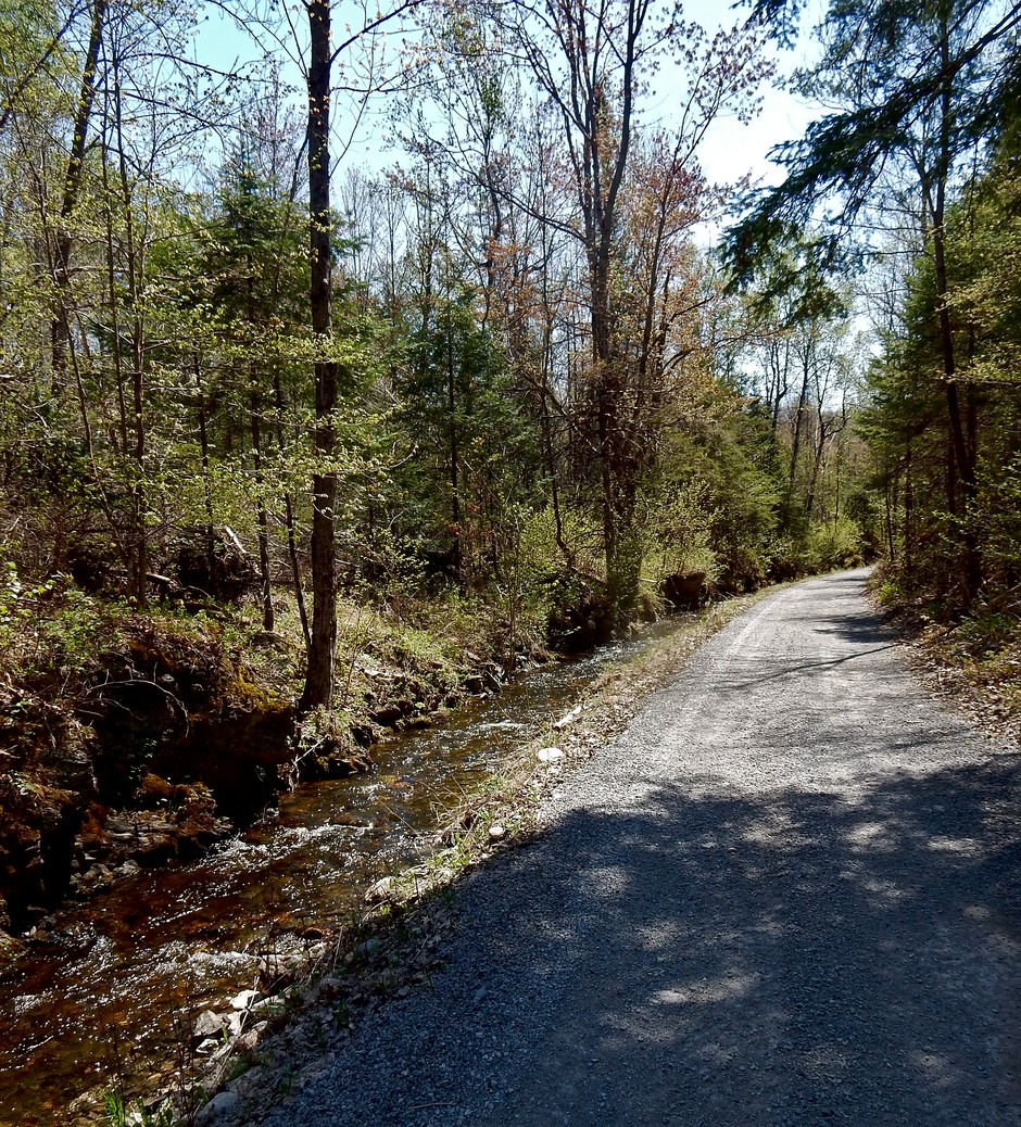
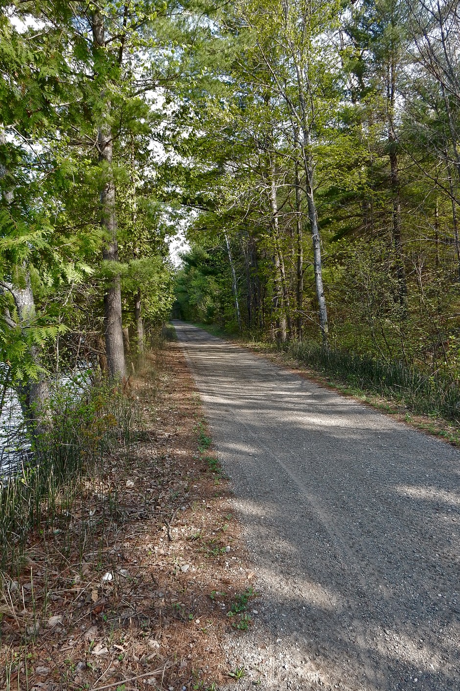
The K&P Trail starts off as stone dust but becomes hard pressed crushed stone or soil for most of the way. Unlike the Booth Trail, it is decent to ride, though not of city park quality. There are some pot holes and wet spots, but nothing extreme. It is an extremely beautiful trail through wilderness and exceeded my expectations in that regard. I saw many deer, a Red Headed Woodpecker, a Rose Breasted Grosbeak, and a Yellow Warbler. After 17km on the trail I reached Calabogie Road and turned right, hoping to find a campground I had seen online but was unclear if it was still in operation. After a few kilometres, and passing a few motels, I came to the end of the lake and tried a place with a bit of a creepy vibe that said, “Trailer and Tent Camping”. No one was there, and the blackflies were terrible, so I returned the way I came.
Less than a kilometre back along the road, there were a dozen or so trailers on a small property on the lake. Across the road was a house that said, “The Ridges”. I didn’t think the trailers and the house were related, but it turns out that they are. There were a couple of women with three or four kids at one of the trailers, so I asked them if they had tent sites. One of the women said that they do, and that she would call the owner for me. She couldn’t reach him, but very kindly walked me down to where I could camp, which was right next to the water, in a small but nice spot. She left the owner a message and said she’d let me know if he got back to her. She said that it was a new owner and the place just changed hands on Tuesday and that the place across the street was their clubhouse, which is also where the washroom is. The clubhouse is two big rooms – one with Visa machines, phones, and other assorted office supplies, and the other room is set up like a meeting room with big tables. The washroom is just the washroom of that office, with no shower – a bit strange for a campsite washroom facility. I returned to my site, and the woman came back before long and told me that the owner asked her to collect $30 for the site. The wind off the lake kept the blackflies at bay and I was happy to have somewhere to stay, even if the amenities were a bit lacking.
Day 4 - Calabogie to McDonald’s Corners May 17, 2018
I rode back to the K&P trail and headed south for about a kilometre before reaching Lanark Road, which is a well paved country road. I turned on Barryvale Road and followed it and Tatty Hill Road to find the K&P trail again around the bottom of the lake. Those roads get smaller and smaller as you continue along them, eventually becoming dirt. At 11km from the campsite I reached the trail, which was similar to the section I rode yesterday. At some point before Flower Station the trail becomes a tiny dirt road, and even has signs to watch for logging trucks. At Folger, which is comprised of one house as you cross Folger Road, the K&P became more of a trail again. It is still a very pretty trail, though not as strikingly so as between Renfrew and Calabogie, and there are quite a few ruts and stones along the path, so it may not be suitable for everyone.
I think that if the K&P Trail was part of a cycle route you would want a road alternative for some people. With that in mind and being very tired from having to ride slowly to avoid obstacles, I decided to cut off on the 16 (Lavant Road) to the 509 and to Snow Road Station. During my entire time on the K&P trail I never saw another person. The 16 and 509 were extremely nice to ride on. Rolling, well paved country roads with very little traffic through nice wooded areas. I had ridden 59km for the day when I reached Snow Road Station. I took the 36 to Elphin from there, which was very nice as well for another 6km. From Elphin, I took the 12, which was still a nicely paved road, though it had a bit more of a thoroughfare feel to it, and the country was more open. Still very little traffic though.
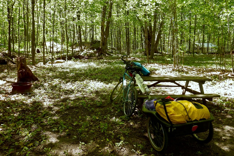
I was happy to see that the town of McDonald’s Corners was more than just a name on a map. It had a church, several houses, and most important a convenience store. I managed to get an ice cream bar and spaghetti sauce. I was happy that I wouldn’t be stuck eating plain noodles for dinner. The blackflies were terrible every time I stopped, which kept me moving, and I made pretty good time. After a long 86km ride, almost half of which was on the K&P trail, I reached Casawinati Campground. Casawinati Campground was a bit of paradise. It’s a nice spot along the river with the mobile homes quite a bit more spread out than at my previous campsites, and it’s like a real campground with amenities. Run by a friendly woman, who looked up the forecast for me (still sunny tomorrow),and gave me a site near the river and next to a shelter with a couple of benches and three picnic tables in it. The bathrooms are really nice and even have books for loan. It’s also the first place you don’t need to put coins in to get hot water for a shower (or like last night having no shower at all), and for some reason there weren’t any blackflies...
Day 5 - McDonald’s Corners to Delta May 18, 2018
I left between 7:30 and 8:00 AM, leaving a robin feeding her chicks in the shelter as a woodpecker pounded on the metal roof. Country Road 7 is a fine road, though it is a tad busy at that time. Harper road was quite nice, but it seemed a bit jarring to cross busy Highway 7 after so many quiet roads and trails. Glen Tay Road was quiet and had a bit of a shoulder. It’s decidedly more developed here though. The 10 is quite terrible really, it’s a thoroughfare with no shoulder at all, and though the traffic isn’t heavy, it’s not light either. Fortunately it’s not long, and you are very soon on the 14 which is a quiet and nice country road that gets even quieter as you get closer to the Narrows. The country here is more open than yesterday, and the forests seem to have recently reclaimed the farmland and are young and scrubby looking for the most part. There are a couple of big solar installations along the route. Crossing the lock is a pleasant experience, and it is a nice and quiet ride from there to Crosby.
It seems like you’re at the wrong place when you get to Crosby as the 15 looks like the only option, and it’s a very busy highway. But turn left for a few metres and you can see that the 42 continues across the road. The 42 is quiet and an OK ride, but it is open farmland now, and is a bigger road after all of the country roads of yesterday. An alternate route being considered for the trail would run on side roads near Portland and would add 8.5km to the ride. It always feels weird to just add distance like that, but it may be worth it as it would be nicer on the smaller quiet roads.
Delta is only 60km from Casawinati Campground, which was nice after the long day yesterday. Delta looks like it once was a nice town, but sadly the eight or so old stores that make up the downtown are all closed and everything is for sale. Other places around town look closed as well. I went past the campsite turnoff because I felt desperately as though I needed something substantial to eat, and fortunately there was a chip stand run by a really nice guy not far past the campsite turnoff. I got a burger and poutine for lunch, as it was still just noon.
If the town of Delta is dead, Lower Beverley Campground is not. It was quite the happening place, with people rolling in for the long weekend. They have 235 campsites, 106 acres of parkland, a softball complex, minigolf, shuffle board and a small beach. The canteen was supposed to open today, and they were going to have karaoke that night. Showers are free with lots of hot water. While it doesn’t have the charm and personal touches of last nights site, it has everything you could need.
I have a bad feeling about sleeping here tonight though. It’s only dinner time and country music is already blasting over the site, and two young couples with pick up trucks just took the site next to mine, and are already setting up the fire and getting the beer out, just twenty feet from my tent.
Day 6 - May 19, 2018
Well those two couples stayed up all night long, listening to music, and eventually devolving into hours of emotional drunken discussions. I won’t go into details about all of the drama, but at most I slept one or two hours and got up at 5:30 and was on the road before 7AM. It was calm and clear out, but I knew it was supposed to rain later so I tried to keep moving to beat it.
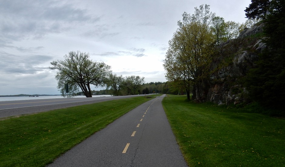
The 42 was very quiet. I planned to go down the east side of Charleston Lake on an alternate route being considered for the trail, so I stayed on the 42 past the 33 and turned on Black Church Road, which was gravel. I stayed on this and made the first left on an unlabelled road, which was also gravel, and unexpectedly brought me back to the 42. I decided to bail on riding the east side, as I didn’t want an unpleasant ride on a gravel route, and so headed back to the 33 to go around the west side of Charleston Lake. The 33 and 3 were both really nice wooded country roads, well paved and quiet. Turning onto the 4, the route becomes open farmland, which continued through to Mallorytown. It seemed very slow going for much of that stretch, with a slight uphill combined with a light headwind. I went through Mallorytown to the 2 and down the 5. They are all nice paved roads. The 5 brought me to the Bikeway with 14km to the bridge. The Bikeway is a nice paved bike path with views of the Thousand Islands. Eventually it started to spit, and then pour for my last few kilometres. That’s not too bad as it was the only rain I rode in the entire week.
I went to Ivy Lea Campground next to the bridge to await my lift. I arrived at 11:15 after a 65km day on what was a really decent cycle route. The folks at Ivy Lea Campground were very friendly, and I bought a coffee and bag of sour cream and onion chips and sat at a picnic table under its umbrella just outside the store/registration to enjoy them. I then showered and changed into dry clothes. My ride arrived shortly thereafter.
So now that it’s over, what do I think? It was certainly an interesting and varied route, perhaps partly because some of it is not ready as a bike route and there was some decision making and discovery along the way. I’m interested to know how the folks at the Algonquin to Adirondacks Collaborative came up with the route, and where the best wildlife corridors are in relation to it. It seems to me, just from looking at a road map, that for the northern portion, the best wildlife corridor would be a bit west of this route for the most part, and through the Madawaska Highlands, into Mazinaw Country and Land’ O ‘ Lakes. The K&P Trail I found a bit problematic. Although it’s a very nice bike ride, it is a very different sort of ride than the rest of the route, and I’m not sure what cyclist the long-distance trail would appeal to. It is a long day from Calabogie to any reasonable accommodation going south on that trail. For a non-tenting trip there weren’t a lot of options, and for a tenting trip it’s a long way to McDonalds Corners and the first campsite.
Overall the A2A trail is a great route with a lot of potential. I look forward to seeing how it progresses.
Recommendations
- Due to the condition of the trail, the Booth Trail is not a viable option for a cycling route.
- The shoulders of Highway #60 should be widened to at least two feet where they are not already that wide.
- Investigate Yantha Road to east of Barry’s Bay as a connection to Mountainview Road to get off of Highway 60 a bit earlier.
- I didn’t follow Mountainview Road properly and ended up back on Highway #60 so I can’t say if Mountainview Road is decent for cycling. Clear signage and a description would need to be provided if this was to be part of the route.
- The K&P Trail needs to be made more cyclist friendly. As it is, I would say that the K&P Trail has a feel that is almost hostile to cyclists. The only signs on it indicate that it is a snowmobile trail. Other signs say that you need to be a member to use the trail, which I assumed to mean for snowmobiling the trail, but wasn’t sure so didn’t feel very welcome. There is no indication that it’s a multi use trail. Also, at many places where it crosses a road, the lead up to the road has just had loose gravel poured between the road and trail, which was difficult or impossible to ride through for a cyclist. Putting some effort into a cycle friendly transition when crossing roads, and putting some signs to indicate that it is a walking and cycling trail would make a big difference.
- A decision about the K&P Trail needs to be made, which requires a broader clear decision about the cycling/walking routes and whether they are to be the same trail their entire length, or if there will be two routes, one cycling and one walking, which will just share some overlap. The K&P Trail, although a beautiful trail, is a very different sort of ride than the rest of the trip and it is unclear to me that the combined types of riding will appeal to many people. I would recommend that an alternate road route be found as an alternative to the K&P Trail. Perhaps the road option could just be an alternative for some cyclists.
- A small thing, but just south of Delta along the #42 is a road called Hicock Lane which runs down to the #33. I think that this should be considered for the route, rather than continuing down the #42 to the #33 on these much bigger roads.
- If it hasn’t already been considered and rejected, consideration should be given to the cycle route going more to the west than it does. On Highway #60, just past Barry’s Bay, a route could turn onto Yantha Road, and then continue along the Historic Ottawa and Opeongo Colonization Road all the way to Dacre near Calabogie. Randomly looking at sections of it on Google Street View it appears to be paved, and it seems as if it would be very wilderness like and quiet.
- The short stretch of Highway #10 by Scotch Line should have a shoulder for bikes if it is to be part of the route.
- I planned to take this trip as a kind of wilderness cycle route, tenting the entire way. I would recommend against this type of cycling route as I don’t think the Booth Trail is realistic, and there are very few campgrounds to chose from on or near the route. For my second night I had to come far off of the route to get to Smiths Bay Campground on Lake Dore, and following this it is a very long way to the next one. There are very limited choices of campsites throughout most of the route. So I would recommend that this cycle trip should be taken with the idea of buying food and staying at B&Bs and Inns in the little towns, which I think would be very practical. More of a “bike and credit card” type trip. It would be good if the A2A Collaborative had literature to give to all of the B&Bs/Inns about the wilderness in the specific area, and the corridor in general. Possibly identifying different B&Bs/Inns along the route as bike friendly, based on some criteria would be a good idea as well, as they do for the P’tit Train du Nord.
The Route I Ended Up Following
- Started at Mew Lake Campground
- Highway #60 to Whitney
- From Wilno I took Wilno South Road (#66) to Mountainview back to Highway #60
- Highway #60 to Mill Street and Killaloe
- From Killaloe, south on Queen Street to #70 (Ruby Road which becomes Kokomis Road)
- This brought me back to Highway #60
- Then Highway #60 to Germanicus Road and then Smith’s Bay Road
- Returned next day along Smith’s Bay and Germanicus to Highway #60
- Highway #60 east to Eganville then briefly on Highway #41 to Fourth Chute Road
- Fourth Chute Road to Highway #60 for a couple hundred metres to #5 (Stone Road)
- #5 to Highway #132
- Headed east on Highway #132 for a couple of kilometres to the K&P Trail
- Followed the K&P Trail to Calabogie Road (#508) and headed west for a couple of kilometres
- Returned next day east on Calabogie Road to the K&P Trail
- South on K&P Trail for a kilometre to Lanark Road
- Lanark Road to Barryvale Road then Tatty Hill Road to the K&P Trail
- K&P Trail to #16 (Lavant Road) then # 509 to Elphin-Maberly Road (#36) to Elphin
- From Elphin I took McDonalds Corner Road (#12) to Playfairville
- From Playfairville took Fallbrook Road (#7) to Keays Road then Harper Road
- On Harper Road across Highway #7 where it becomes Glen Tay Road
- Glen Tay Road to Scotch Line (#10)
- Scotch Line to Narrows Lock Road (#14)
- #14 crossed the lock all the way to Crosby
- From Crosby east on Highway #15 for a hundred metres then east on Highway #42 past Delta
- Delta to Lyndhurst Road (#33) to Lyndhurst
- From Lyndhurst south on (#3) to Warburton Road (#4) to Rockfield Road (still #4)
- Rockfield Road becomes Quabbin Road and continues to Mallorytown
- From Mallorytown east on Highway#2 to Mallorytown Road (#5)
- Mallorytown Road took me down to the Thousand Islands Bikeway
- Followed the Bikeway west to Thousand Islands International Bridge